This shows the washout under the Big Pine from across the river. Photo by Ren Holland, July 3, 2020.

Riverbank Washouts from Large Storm Threaten Weyerhaeuser Museum

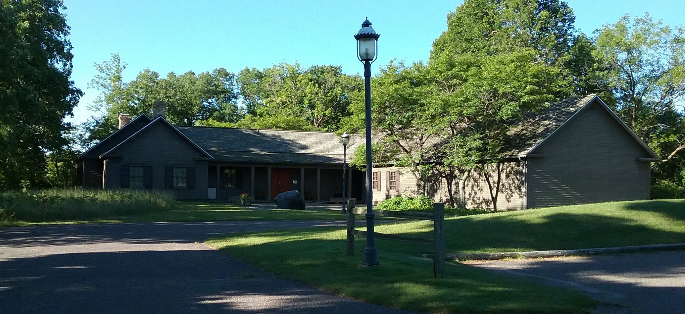
From approximately 4 p.m. until 10 p.m. on Monday, June 29, 2020, some portions of Morrison County received over 8 inches of rain in a thunderstorm system that stalled over the area. The Charles A. Weyerhaeuser Memorial Museum, home of the Morrison County Historical Society, sits on a high bank on the west side of the Mississippi River in Little Falls, MN, at the confluence of Pike Creek. The storm washed out massive portions of the riverbank next to the museum.

The Morrison County Historical Society has been monitoring the riverbank erosion along its property for the past number of years. The natural action of the river coupled with severe storms over the past 10 years has significantly impacted the shoreline. This is of grave concern because the museum building at its closest point sits only about 20 feet away from the upper edge of the bank.

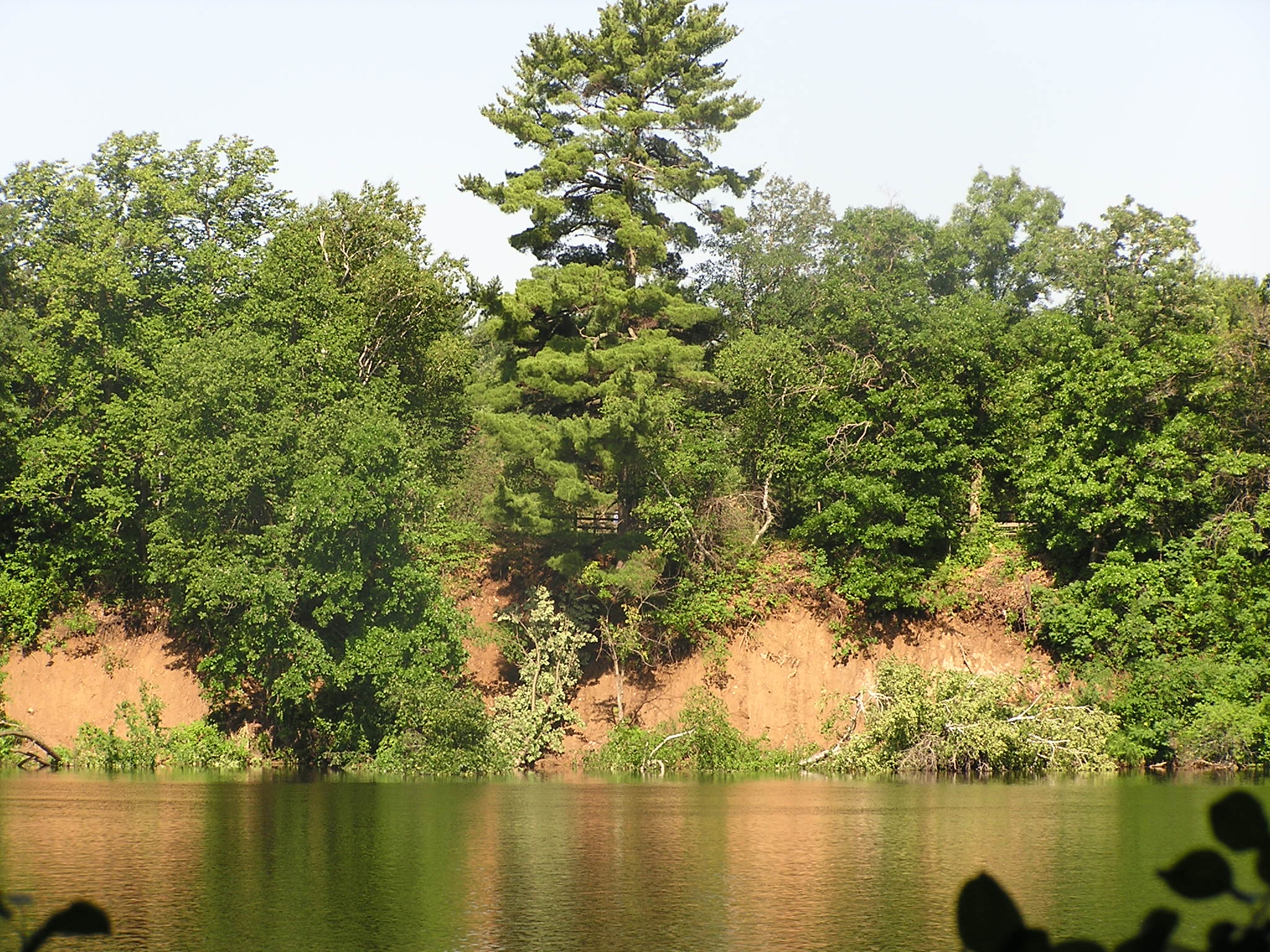
This is a story best told in photos, which are below. A pontoon excursion courtesy of Dennis Dzieweczynski on July 3, 2020, allowed MCHS board members Pat Quinn and Ron Jones, along with executive director Mary Warner and her husband Erik, to get photos of the washout from the June 29th storm. Ren Holland, MCHS Building & Grounds Committee member, also provided photos of the washout from the opposite shore.

Because the bank is so steep next to the museum, it is difficult to get photos that show the washout in relation to the building. To get a sense of the relationship, the following photos use the fence and giant white pine tree (called the Big Pine by MCHS) on the shore near the museum for orientation. Some of these photos may not accurately present the scale of the landmarks in relation to one another. These are best determined by being on-site. (In other words, this is a much scarier situation in person!)

MCHS is currently working with various agencies in order to find a solution to this problem. We will provide updates as we learn more.

This photo shows the relationship of the Weyerhaeuser Museum to the fence at the closest point - approximately 20 feet between building and fence. Photo taken April 16, 2019.
This photo shows the relationship of the Weyerhaeuser Museum to the fence at the closest point – approximately 20 feet between building and fence. Photo taken April 16, 2019.
This shows the proximity of the fence through the museum's window. Taken May 11, 2019.
This shows the proximity of the fence through the museum’s window. Taken May 11, 2019.
This is a winter shot of the museum taken from under the Big Pine. It shows the relationship of the Big Pine to the museum and the fence. Taken December 21, 2019.
This shows the proximity of the fence to the Big Pine. Taken July 6, 2020.
This shows the washout under the Big Pine from across the river. Photo by Ren Holland, July 3, 2020.
This shows the roof of the museum above the washout. It was taken from a pontoon on the river below the washout. Taken July 3, 2020.
This shows the washout under the Big Pine. Note the fence behind the Big Pine and how much of the pine's roots are exposed, as well as the trees that are in the water. Taken July 3, 2020.
This shows the washout under the Big Pine. Note the fence behind the Big Pine and how much of the pine’s roots are exposed, as well as the trees that are in the water. Taken July 3, 2020.
This shows that the washout extends south of the Big Pine. Taken July 3, 2020.
This shows more of the washout extending south of the Big Pine alongside the museum's east side. Note the museum's roof in the upper right corner of the photo. Taken July 3, 2020.
This shows more of the washout extending south of the Big Pine alongside the museum’s east side. Note the museum’s roof in the upper right corner of the photo. Taken July 3, 2020.

And finally, a Before & After photo that shows the erosion in 2016 versus the erosion from the June 29, 2020, event.

Top photo shows erosion on the riverbank beneath the Big Pine by the Weyerhaeuser Museum in 2016. The bottom shows the erosion after the June 30, 2020, massive rain event.
Top photo shows erosion on the riverbank beneath the Big Pine by the Weyerhaeuser Museum in 2016. The bottom shows the erosion after the June 29, 2020, massive rain event.


Leave a Reply