Have you heard of Google Street View? It’s a function of Google Maps that allows you to see street-level photos of locations around the world. There’s been some controversy about Google Street View because of privacy issues. The Google Street View vehicle drives all over the place capturing continuous photos of streets with the cameras it has mounted to the roof. There are several images online of what this vehicle might look like, but I can’t determine which is accurate. Maybe Google has more than one sort of Street View vehicle.
When I first heard of Google Street View, I went to Google Maps and looked for my home address. Nothing. No Street View. There were Street Views for big cities, but nothing smaller. Now that Google’s been working on this for a while, it’s gotten out to more rural areas, including Morrison County. That’s right, folks. Google now has Street Views for the sleepy hamlets of our county. Pierz, Genola, Little Falls, Royalton, North Prarie, Upsala, Swanville, Flensburg, Randall, Bowlus, Buckman, Elmdale – they’ve all been photographed by Google.
Belle Prairie, Cushing, Lincoln, Sobieski, Freedhem, Motley, Lastrup, and Hillman don’t have Street Views available yet, but there may be roads near these towns that have been photographed. If you enter the name of one of these towns into Google Maps and see a yellow person icon above the zoom-in, zoom-out (plus & minus) feature on the map, that means Street Views are available for roads near your desired location. If you click and drag the yellow person onto the map, the roads that have Street View will appear highlighted in blue. You can drag your person to one of these roads, drop it on the road and a photo will show up. (Note: You may have to zoom out on the map in order to find the roads that highlight in blue.)
If you enter a specific address into the search function and there is a Street View available, it will appear as a photo and a link within a little box that hovers over the map.
Once you are in Street View, you can move around by following the arrows that appear on the street. Click on a street arrow in order to “drive” down the street. Use the other navigation tools in the upper left-hand corner to turn yourself in different directions, or to zoom in and out.
One thing you’ll notice immediately when you zoom in is that the image quickly becomes pixellated and blurry. This is on purpose and is to quell the fears of those attempting to protect our personal privacy online. Any people that appear in Google Street View will have their faces blurred. So will the licenses on vehicles. Most of the signs are pretty blurry as well.
While Google Street View is good for a general gander around a town or neighborhood, it’s not very good for history. There are no dates on the photos, other than Google’s copyright. Sometimes it’s really obvious that the photos along a particular street were taken at different times/dates. Several shots will show the sky completely overcast and then there’ll be one shot showing the sky to be perfectly clear and sunny. (I found this specific example while using Street View with Pierz, Minnesota.)
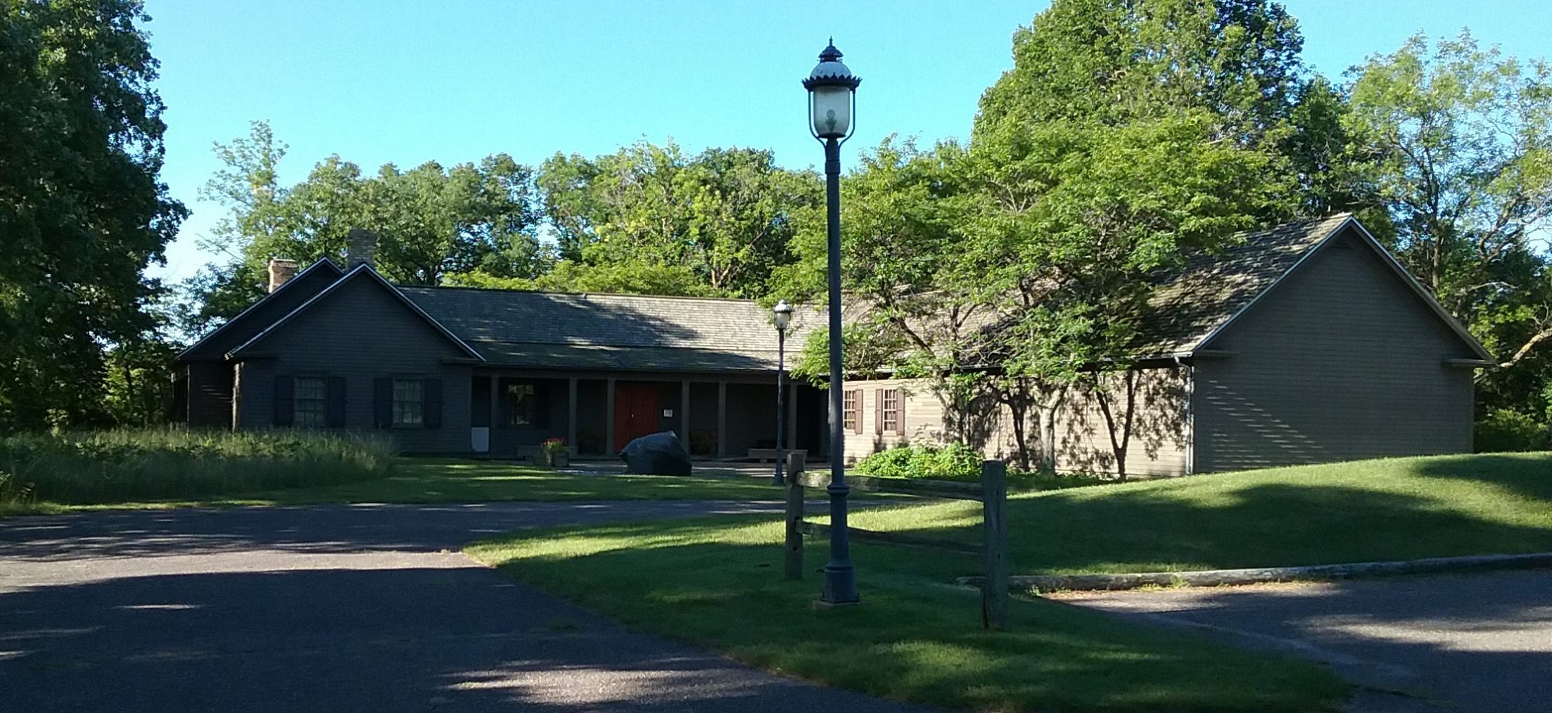
By examining the photos of my home, I could tell that Google must have been in our area somewhere between July and September 2008. I know this because there are leaves on the trees and one of our political signs is in front of the house, but the other is not. I also examined the area where the old Central Office Building used to be and it is no longer there. The building was demolished some time last summer and I could date the Street Views more closely if I had my dated digital photos of the demolition in progress in front of me.
The lack of identifying features (all that blurriness!) also makes practicing history difficult with Street View. In many cases, it’s impossible to read the names of businesses or other signs. (The Weyerhaeuser Museum sign is unreadable.) I also couldn’t read our house number (good for privacy) and Google approximates addresses, so these aren’t always correct.
For as fun or scary (depending upon your viewpoint) as Google Street Views are, without specific dates, better details, or a person who recognizes the context of the photos, they can’t be counted on for historic documentation, which is a shame because of all the energy that went into producing this resource.
(Our curator, Ann Marie, asked a good question: Will Google be updating these photos on a regular basis? Street Views change. Think about that Central Office Building that is now gone. With as quickly as buildings are constructed and demolished, it won’t be long before the photos in Street View are inaccurate.)