Road maps are mesmerizing. I can look and look and look at them, no matter how familiar I am with the towns and roads.
A couple of fascinating Minnesota road maps were unearthed from the Morrison County Historical Society’s collection recently. Strangely, they were maps my husband and I donated years ago without much thought to their significance.

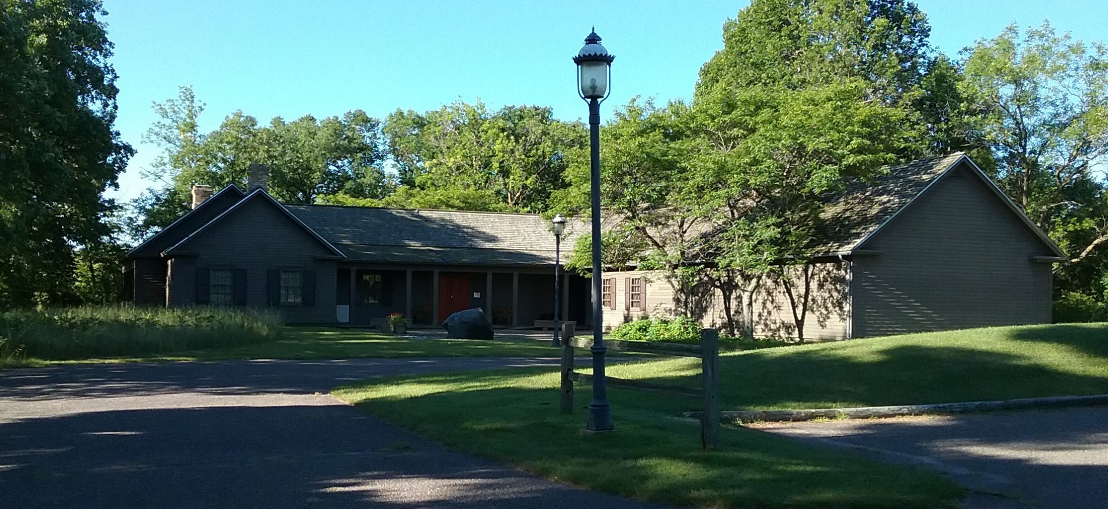
Back in 1993, when my husband and I purchased our 1894 yellow brick house on the northeast side of Little Falls, we discovered a number of documents and housewares left by the previous owners, Beulah and William Mueller. William, who owned Mueller’s Service & Tire Station on Highway 10 south of Little Falls, died August 7, 1974. He and Beulah married in 1929.
Beulah was the daughter of Knut(e) and Christine (Silver) Elvig. She was born January 20, 1896. According to a note within our Family Files, she was born and married in what is now our house. This explains the 4 cement support posts we found when we removed the rotting front porch. They are all inscribed with her father’s name and are still in the yard.
Beulah lived in the house until she was well into her 90s, donating it to First United Church when she moved to the Lutheran Senior Citizens Home in Little Falls.
Among the documents we found in the house were records from Oakland Cemetery in Little Falls, a stack of Selective Service cards, a large, ornately-framed portrait of a little girl that looked like Beulah as a child, along with various sundry documents found in a trunk in the fallen-down garage.
Beulah was the secretary-treasurer of Oakland Cemtery for over 40 years, retiring from the position in 1986 at the age of 91. She also was the the registrar for the local Selective Service Office between 1940 and the mid-1960s, “inscribing on government forms the names of all the local boys who were drafted in World War II.” (Mary Phillips, St. Cloud Daily Times, April 30 1987)
We hung the portrait, which we found in the basement behind the fuel tank, in the living room for a number of years before donating it to the Morrison County Historical Society. We gathered up the documents, including the maps, and brought them to the Weyerhaeuser Museum on September 25, 1997.
Over 20 years later, as part of the Arts and Cultural Heritage Fund grant we received through the Minnesota Historical Society to install mobile shelving in the Archives, we have hired a contract archivist to sort through documents from this as well as several other large collections. Our contract archivist is Mike Worcester, formerly the executive director of the Cokato Museum and Akerlund Studio in Cokato, MN. Mike married Morrison County native Jody Rakow and gave up his job in Cokato in December 2018 because of the long commute.
As he sorts and arranges these collections, he shows me some of the interesting items he is discovering. The two maps are among his finds.
One was issued by the Minnesota Highway Improvement Association. It is dated 1920 and features the “Babcock Plan for a Trunk Highway System in Minnesota.” The important thing to remember when looking at this map is that the trunk highway system is proposed … it’s not built yet. The proposed highways appear in red. The map has a purpose other than setting a vision for a trunk highway system. It encourages people to “Vote “Yes” for Constitutional Amendment No. 1, on November 2, 1920.” The amendment would create the trunk highway system in Minnesota, “about 7,000 miles of arterial roads distributed over the state as illustrated by this map” without raising taxes. Instead, the amendment would “authorize the Legislature to tax motor vehicles on a different basis than other personal property.”
It’s fascinating to look at the proposed highways on this map and see how they compare to the highways that came to be. In Morrison County, the Babcock Plan shows Highways 27, which is Highways 10 and 371 today; 28, which ran west from Little Falls to Long Prairie and is now part of Highway 27; and 37, which ran along the Highway 10 route from Little Falls to Lincoln.
Amendment No. 1, also referred to as the Babcock Amendment, passed at the November 1920 election and birthed the trunk highway system. Morrison County saw 4,818 voters in favor of the amendment and 2,069 opposed. (Little Falls Herald, November 12, 1920)

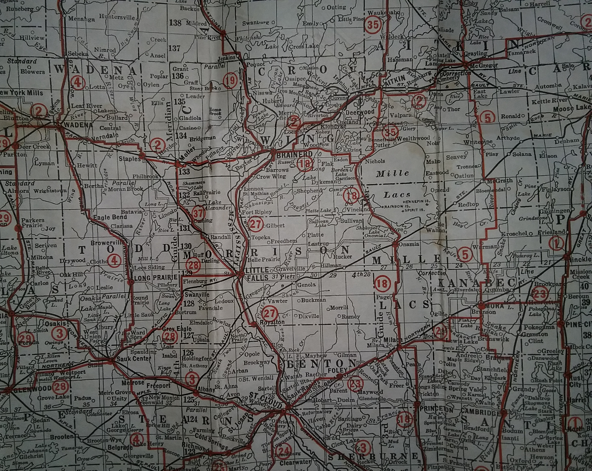
The second map Mike found in the Mueller collection is an “Official Standard Auto Road Map of Minnesota” from 1927 published by Hudson Map Company. This is only seven short years after the Babcock Plan map and you can see from this map how much of the trunk highway system has been developed.
The map key delineates paved roads, gravel roads, and dirt roads. It also shows which ones are under construction. The gravel roads are noted by checked blue and white lines. A quick glance at the map reveals a lot of gravel roads. Looking closer, the dirt roads are also prevalent. It’s the paved roads that are in short supply. These show up in the Twin Cities metro, a couple in the Iron Range area, and a long stretch from Anoka to St. Cloud, continuing through Little Falls and up to Brainerd.
Yep, paving was here in Morrison County along the route that is now Highway 10/371 (labeled 27 on this map) at an early date. Aside from this paved highway, the rest of Morrison County’s highways were dirt and gravel in 1927.
These maps are two of the gems that have been sitting in our collection, unbenownst to staff, for over two decades. When you have a collection that contains tens of thousands of items, it’s difficult to know each individual item. Thanks to our grant from Minnesota’s Legacy Fund and the assistance of our contract archivist Mike, we can now share these recently excavated maps.
~ Mary Warner
Executive Director
This article originally appeared in the Morrison County Historical Society newsletter, Vol. 32, No. 4, 2019.